How Snow Forms Explained Simply
In this post
- Snow Starts as Vapour, Not as Rain
- Why Every Snowflake Has Six Sides
- From One Crystal to a Falling Flake
- Why Snow Can Fall When Air Is Above Freezing
- Why Snow Looks White When Ice Is Clear
- Powder, Wet Snow, and Ice: What Changes the Feel
- Snow, Rain, Sleet, and Hail Are Not the Same
- How to Watch Snow Forming Yourself
- Snow on Roads, Roofs and Rivers: Why the Same Snowfall Is Not the Same Everywhere
- My Take:
Snow Starts as Vapour, Not as Rain
Snow does not begin as liquid rain that freezes on the way down. It begins in a cold cloud, where water vapour — invisible water gas — turns directly into ice. That direct change from gas to solid is called deposition. It happens when the cloud air is below freezing and contains tiny particles for ice to grow on. Without those particles, vapour would struggle to form a crystal at ordinary cloud temperatures. Dust, pollen, sea salt, soil, and other microscopic particles act as nuclei, giving the first ice molecules a surface to attach to.
Once a tiny crystal exists, more vapour freezes onto it. The crystal grows because the air around it is saturated with moisture, meaning vapour is available to join the solid. The shape it takes depends on temperature and humidity as it grows. A crystal that stays in one stable zone grows evenly. A crystal that falls through changing zones grows different features at different times, recording its journey in its branches. That is why a snowflake can be read, roughly, as a history of the cloud it fell through.
Clouds themselves are not solid objects. They are collections of tiny droplets or ice crystals so small and light that air currents keep them floating. A snow crystal becomes heavy enough to fall only after it has grown, or after many crystals have stuck together. The moment of falling is therefore a size threshold, not a sudden change in weather. The cloud may look the same from the ground before and after snow begins.
Why Every Snowflake Has Six Sides
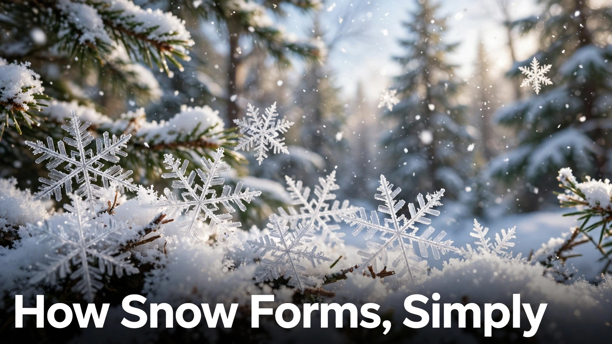
Water molecules have a bent, V-like shape, and when they lock into ice they bond in a hexagonal pattern. That molecular geometry repeats at larger scales, so ice crystals grow with six-fold symmetry. The National Oceanic and Atmospheric Administration explains that snowflakes build six arms because water molecules arrange themselves in predetermined spaces during crystallisation, forming a six-sided structure. Temperature then decides the basic form: NOAA notes long needle-like crystals around 23 degrees Fahrenheit and very flat plate-like crystals around 5 degrees Fahrenheit, with humidity playing a smaller role.
The six arms look alike because they experience almost the same conditions at the same time. As the crystal falls, all six arms pass through the same temperature and humidity zones together, so they grow in near-identical ways. Small differences still occur, which is why perfect symmetry is rare in nature. Research summaries note that fewer than 0.1 percent of snowflakes show ideal six-fold symmetry, even though the underlying pattern is hexagonal. The popular claim that no two snowflakes are alike needs that qualification: very small, simple hexagonal crystals can look almost identical, while large branched flakes are almost never repeated exactly because their growth history is too complex.
Twelve-branched flakes are occasionally observed, but they still preserve six-fold symmetry, often because two crystals joined. That detail shows how the rule works: the hexagonal lattice governs growth, while collisions and joining can create apparent exceptions that still follow the underlying pattern.
From One Crystal to a Falling Flake
A single ice crystal is usually too small to notice. What we call a snowflake is often an aggregate — many crystals stuck together as they collide in the cloud. The Open University explains that snowflakes form when many tiny ice crystals suspended in clouds collide and stick together, a process called aggregation. Nimbostratus clouds, the thick grey layers that bring steady precipitation, generally contain enough ice crystals for this to happen at scale. Other clouds may hold a mix of ice and supercooled water droplets, where water can freeze onto ice and, if it melts on the way down, become rain instead.
Aggregation explains size variation. A light dusting may consist of small, separate crystals. A heavy snowfall with large, soft flakes usually means crystals had time and moisture to join into bigger clusters. Large flakes fall more slowly and feel softer because they trap air between crystals. Small, hard grains, sometimes called graupel, form differently, when supercooled droplets freeze onto a crystal and coat it in rime, producing a pellet rather than a branched flake. Knowing that distinction helps explain why “snow” can feel powdery one day and icy the next, even at similar air temperatures.
Wind also matters. Strong updrafts can keep crystals in the cloud longer, letting them grow larger or collide more often. Calm air lets smaller flakes fall sooner. That is why snow can be fine and dry in still, very cold air, and large and wet when temperatures are near freezing and the air is moist.
Why Snow Can Fall When Air Is Above Freezing
It seems contradictory, but snow can reach the ground even when the thermometer at ground level reads slightly above 0 degrees Celsius. The Open University notes that an air temperature of 0 degrees or lower is not necessary for snow, because as the edges of a flake begin to melt, the water produced evaporates and cools the air around the flake. That evaporative cooling can keep the flake largely intact through a shallow warm layer, especially if the air is dry.
The full column matters more than the ground temperature alone. If the air from cloud to ground is mostly below freezing, flakes survive. If a deep warm layer sits in the middle, flakes melt into rain. If a shallow warm layer is followed by a cold layer near the ground, partially melted flakes can refreeze into sleet, which is small ice pellets, not snow. The United States National Park Service gives a simple version of the same rule: snow forms when cloud droplets freeze into ice crystals in very cold clouds, and as crystals stick together they become too heavy and fall; passing through warmer air can cause slight melting, and too much melting produces sleet.
That column logic also explains regional surprises. A mountain town can receive snow while a valley town a short drive away gets rain, because the valley air column is warmer. A city can see snow in the morning and rain by afternoon as the lower air warms. Forecasters therefore track temperature at several heights, not just at the surface, when predicting snow versus rain.
Why Snow Looks White When Ice Is Clear
A single ice cube is clear. A snowflake is clear too. Snow looks white because of light scattering. Each flake has many small crystal surfaces, and light bounces between those surfaces in many directions instead of passing straight through. The Open University states this directly: each ice crystal is transparent, but snow appears white because the many tiny surfaces within each snowflake scatter light in all directions. A deep snowpack multiplies that effect, with millions of surfaces scattering light back to the eye.
The same scattering explains why snow can look blue in deep drifts or crevasses. When light travels through a large mass of snow, longer red wavelengths are absorbed more than blue wavelengths, so the light that emerges can appear blue. Shallow snow does not absorb enough light for that shift to be noticeable, so it stays white. Dirty snow looks grey or brown because particles mixed into the snow absorb light instead of scattering it cleanly. Fresh snow is therefore the whitest, and old, compacted, or polluted snow looks duller.
Colour can also shift with light conditions. At sunset, snow reflects the warm colour of the low sun and can look pink or orange. Under a clear blue sky, shadows on snow can look blue because they are lit mainly by scattered sky light rather than direct sun. None of those colours mean the snow itself changed composition; they show how snow acts as a mirror for its light environment.
Powder, Wet Snow, and Ice: What Changes the Feel
Snow texture depends mainly on temperature and water content at formation and after landing. Very cold snow is dry and powdery because crystals contain little liquid water and do not stick strongly. Snow near freezing is wet and heavy because crystals are partly melted and bond together. Wet snow packs well for snowballs and snowmen, while dry powder will not pack because crystals slide past each other. Skiers, builders, and road crews care about this difference because wet snow is far heavier to move and more likely to cause roof loads or power-line problems.
After landing, snow keeps changing. Sunlight, wind, temperature swings, and new snowfall reshape crystals in a process called metamorphism. The top layer can melt and refreeze into a crust. Deeper layers compact under weight, squeezing out air and slowly turning snow into firn, then glacial ice over long periods. The National Snow and Ice Data Center material cited in winter-science summaries describes how buried snow recrystallises into larger, denser crystals under pressure. That long transformation is why a glacier is not simply old snow: it is snow whose crystals have been rebuilt by time and weight.
Rain on snow, freeze-thaw cycles, and wind packing can each create distinct layers, which avalanche forecasters study carefully. A weak, powdery layer buried under a hard crust can become a sliding surface. That is a practical reason to understand snow formation beyond curiosity: the history of how snow formed and changed determines how it behaves on a slope, a road, or a roof.
Snow, Rain, Sleet, and Hail Are Not the Same
Confusion between winter precipitation types is common, but each has a different formation path. Snow forms from vapour freezing into ice crystals in a cold cloud and falling as crystals or aggregates. Rain forms when vapour condenses into liquid droplets that grow heavy enough to fall, or when snow melts fully in a warm layer. Sleet forms when snow or rain partially melts and then refreezes into small ice pellets before reaching the ground. Hail forms in strong thunderstorms, where powerful updrafts carry droplets high into freezing air repeatedly, building layers of ice around a core. Hail therefore needs summer-style thunderstorms, not winter cold alone.
Freezing rain is another distinct case: rain falls through a shallow cold layer near the ground and freezes on contact with surfaces, coating roads and trees in clear ice. It looks like rain in the air but behaves like ice on the ground, which makes it especially hazardous. Knowing these distinctions helps a reader interpret a forecast correctly. A forecast of “wintry mix” usually means the temperature column is near the boundary between these types, so small changes can flip the outcome from snow to sleet to freezing rain within hours.
The water cycle ties all of them together. Water evaporates from oceans, lakes, and land, rises, cools, condenses or freezes in clouds, and returns as precipitation. Snow is one return path, favoured when the whole journey stays cold enough for ice. When the journey warms, the same water returns as rain. That cycle view prevents a common mistake: thinking snow is a different substance from rain. It is the same water, in a different arrangement, shaped by temperature at each stage.
How to Watch Snow Forming Yourself
A simple observation can make the science visible. Catch flakes on a dark, cold surface such as a chilled glove or a dark cloth, and look closely with a magnifying glass. You will see hexagonal shapes, but also broken branches, clumps, and simple plates. That variety is the point: the same hexagonal rule produces many forms because temperature and humidity changed during growth. Photographing flakes quickly matters, because warmth from hands or breath melts delicate branches within seconds.
A second observation is sound and feel. Dry powder squeaks underfoot in very cold air because crystals are sharp and do not bond. Wet snow is silent and heavy because crystals are bonded by liquid water. A third observation is timing: large flakes often fall when temperatures are near freezing and the air is moist, while fine, glittering crystals often fall in colder, drier air. Those three checks — shape, sound, and size — give a rough read on the cloud conditions above, without instruments.
For children and curious adults, snow offers a rare chance to see molecular geometry with the naked eye. The hexagon is not an artistic choice; it is water chemistry made visible. That connection — from an invisible molecule to a visible flake — is why snow formation remains a favourite science example. It turns an everyday winter event into evidence that small rules can produce large, beautiful complexity.
Snow on Roads, Roofs and Rivers: Why the Same Snowfall Is Not the Same Everywhere
The same ten centimetres of snow does not behave the same way in every place, and the reason is temperature, wind and what the snow lands on. On a cold, dry night, powder snow stays loose, blows into drifts, and can be cleared with a light shovel, but it also hides ice underneath and reduces grip on roads because tyres meet a dry, slippery layer rather than bare tarmac. Near freezing, wet snow sticks to branches, power lines and roofs, and its weight grows fast: a thick, wet layer can bend a weak branch, block a gutter, or add a heavy load to a flat roof, which is why clearing roofs and checking gutters matters after a wet storm even when the depth looks modest. On rivers and reservoirs, snow is stored water. A deep mountain snowpack in winter becomes spring meltwater, so water managers watch snow depth and density, not just the calendar, to judge how much water will arrive and how fast. In towns, the practical lesson is to judge snow by type, not depth alone: powder calls for grip, visibility and drift awareness, wet snow calls for weight, drainage and slush, and refrozen melt calls for ice. A driver who treats all snow as one thing will brake too late on ice, underestimate a wet drift, or clear a roof too late. A reader who checks temperature, wind and surface — road, roof, branch or river — will make the safer call, and that check takes less than a minute.
My Take:
I think snow is the best proof that simple rules can make extraordinary variety, and that is why I keep returning to it when people say science is abstract. A water molecule is bent. Ice bonds hexagonally. Temperature nudges the growth one way or another. From those three facts, you get needles, plates, stars, clumps, powder, and wet heavy snow, none of them designed, all of them following physics. There is no designer choosing a pretty shape for each flake. There is a lattice, a cloud, and a fall. The beauty is an outcome, not an intention, and I find that more impressive than any intentional design would be.
That view also corrects a lazy habit: calling snow “just frozen rain.” It is not. Rain and snow start differently, grow differently, and behave differently on the ground. Treating them as the same thing leads to bad forecasts in the mind — expecting snow to behave like rain, or rain like snow — and to bad decisions on roads and roofs. When I hear “wintry mix,” I now think in columns, not in single temperatures. Is the warm layer shallow or deep? Is the ground layer cold enough to refreeze? Those two questions explain most winter surprises better than staring at one thermometer.
I also appreciate how snow exposes the limits of popular claims. “No two snowflakes are alike” sounds poetic, but it is only broadly true for large branched flakes. Small simple hexagons can look almost identical, and ideal symmetry is actually rare. A good science explanation should keep the poetry but add the qualification, because the qualification is where the real understanding lives. The same applies to “snow needs freezing air at the ground.” It usually helps, but evaporative cooling and a cold column above can let snow survive a slightly warm surface. Reality is messier than slogans, and messier is more useful.
Watching flakes on a dark glove is, to me, a better science lesson than reading a definition. You see the hexagon, you see the broken arms, you see clumps that are not stars at all, and you realise the textbook star is only one form among many. That direct observation builds a habit I value: check the thing itself before trusting the picture in your head. Snow is forgiving for that habit because it is free, visible, and temporary. It melts, so you have to look now, not later. That urgency is part of its teaching power.
Finally, I think snow formation deserves respect as infrastructure, not just scenery. The same crystals that delight children determine avalanche risk, water supply, road safety, and roof loads. A region that depends on snowmelt for water is depending on exactly this process: vapour to crystal, crystal to pack, pack to meltwater months later. Understanding formation is therefore not trivia. It is a small piece of understanding how water, weather, and human life connect, and why a change in temperature of a few degrees can shift a whole region from snow to rain, with consequences far beyond a pretty morning.
That infrastructure view extends to water supply in a way most winter visitors miss. Snowpack is stored water: vapour becomes crystal, crystal becomes pack, pack melts months later into rivers and reservoirs. A winter with rain instead of snow may deliver the same total precipitation yet leave a region short of water in summer, because rain runs off immediately while snow releases slowly. Temperature therefore decides not only whether a morning looks pretty, but whether a summer’s water arrives on schedule. Climate shifts of a few degrees at the snow-rain boundary can thus change a water system without changing annual rainfall totals at all, which is why forecasters and water managers track snow water equivalent, not just snowfall depth.
I also think snow teaches a useful humility about models. A forecast that says “snow” is really a prediction about a whole temperature column, wind field, and moisture supply, each with uncertainty. When a forecast changes from snow to rain, it is not necessarily a failure of science; it is an update as new measurements narrow the column’s temperature near the critical boundary. Understanding that boundary helps a reader use forecasts better: check the temperature profile and the timing of warming, not just the icon. A snow icon with a warming afternoon is a different day from a snow icon with temperatures falling all day, even if the morning looks identical.
There is a final, personal reason I value snow science: it rewards looking closely at something ordinary. Most people walk through snowfall without examining a single flake, yet a dark glove and a magnifier reveal a geometry lesson, a weather history, and a water-cycle story in minutes. That habit — pausing to examine the ordinary closely — transfers to other subjects. Once you have seen a hexagon emerge from vapour, you are less likely to accept a vague explanation for rain, frost, or fog, and more likely to ask what temperature, what particle, and what journey produced it. Snow is a small, free laboratory that arrives unannounced, and I think we underuse it.
One more practical consequence is road and roof safety, where formation knowledge changes behaviour. Wet snow near freezing is far heavier per centimetre than dry powder, so a modest depth of wet snow can load a roof or a tree branch more than a deeper fall of powder. Similarly, a thin layer of snow over ice, or snow that has melted and refrozen overnight, creates a different driving surface from fresh powder on dry pavement. Drivers and homeowners who treat all snow as identical will misjudge both risks. Checking not just depth but type — powder, wet, crusted, or refrozen — and temperature trend gives a better safety decision than depth alone, and it is a direct application of the formation science in this post.
Snow education also helps children learn measurement honestly. Measuring snowfall depth, noting temperature, and recording flake type over a winter gives a small dataset where patterns emerge: wet snow near freezing, powder in deep cold, crust after a thaw. That dataset teaches more than a textbook diagram, because the child collected it, and it connects weather observation to the water and safety ideas above without any special equipment.
Frequently Asked Questions
How does snow form in a cloud if it never becomes liquid water first?
Snow forms when water vapour in a cold cloud turns directly into ice on a tiny particle such as dust or pollen, a process called deposition. More vapour then freezes onto that crystal, growing it into a snowflake without a liquid stage.
Why do snowflakes have six sides instead of five or eight?
Snowflakes have six sides because water molecules bond in a hexagonal pattern when they form ice. That molecular geometry repeats as the crystal grows, producing six arms that experience similar conditions and therefore grow in similar ways.
Why does snow look white when a single snowflake is made of clear ice?
Snow looks white because the many small crystal surfaces in snow scatter light in many directions instead of letting it pass straight through. A single clear crystal does not scatter enough light to look white, but a mass of crystals does.
How can snow fall when the ground temperature is above freezing?
Snow can survive a slightly warm surface layer if the air column above is mostly cold and dry, because melting at the flake edges causes evaporation that cools the air around the flake. If the warm layer is deep, the flakes melt fully and fall as rain instead.
What is the difference between snow, sleet, and hail in how they form?
Snow forms as ice crystals in a cold cloud, sleet forms when snow or rain partially melts and refreezes into small ice pellets, and hail forms in strong thunderstorms where updrafts repeatedly carry droplets into freezing air to build layered ice balls.
Why is some snow powdery and dry while other snow is wet and heavy?
Powdery snow forms in very cold, dry air with little liquid water, so crystals do not bond strongly. Wet snow forms near freezing, where crystals are partly melted and bond together, making the snow heavier, stickier, and easier to pack into snowballs.