How Many Provinces Pakistan Has
In this post
How many provinces does Pakistan have? The answer is four. But the full answer is longer, because Pakistan also has territories that are not provinces, and the history of how the map reached its present shape explains why people sometimes give different numbers. This post gives the complete answer in simple words: the four provinces, their capitals, the two administrative territories and the one federal territory, how the tiers of government below them work, and how the map changed over time.
The Short Answer: Four Provinces
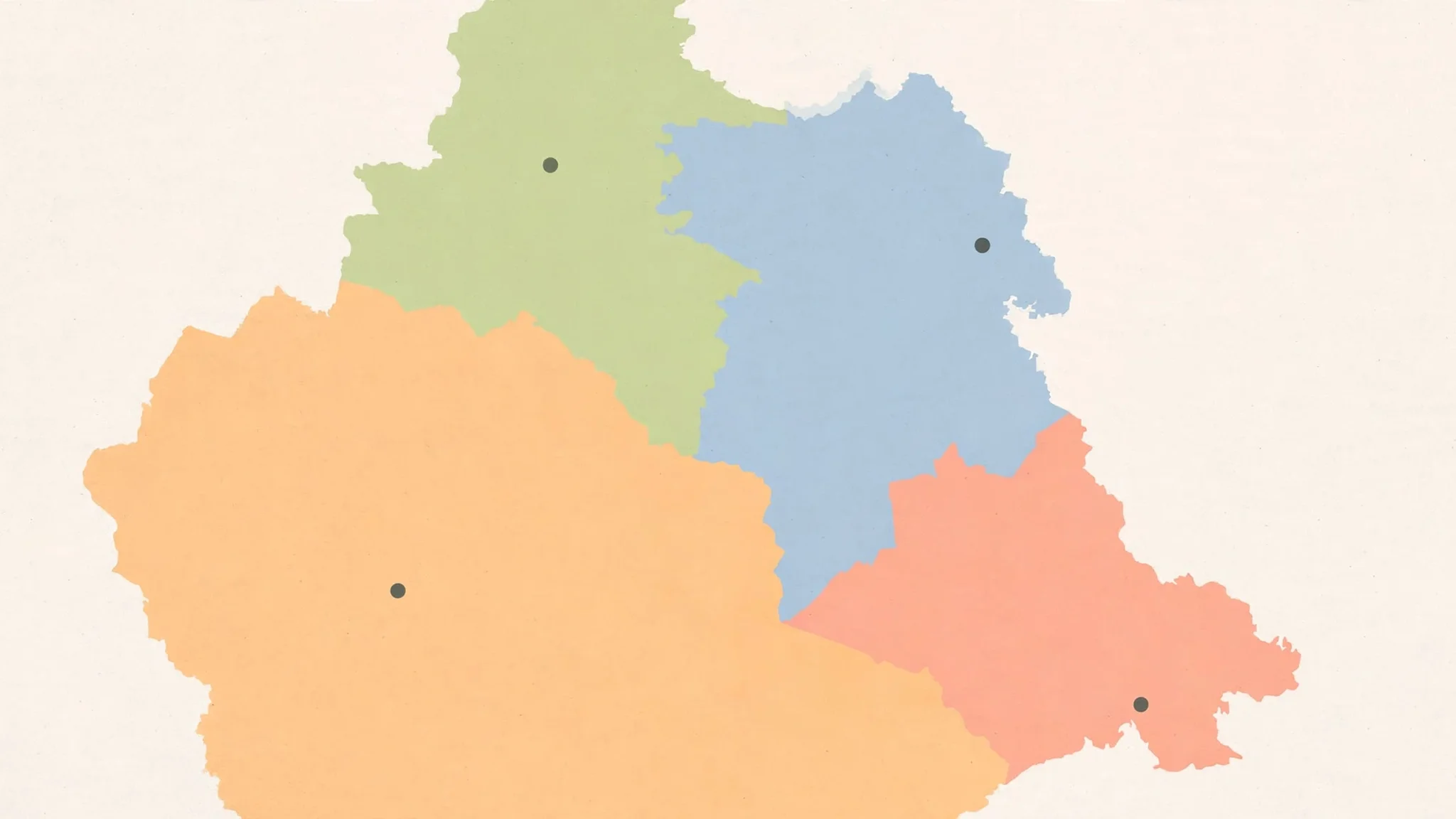
Pakistan has four provinces: Punjab, Sindh, Khyber Pakhtunkhwa, and Balochistan. Each province has its own capital, its own provincial assembly, its own chief minister, and its own governor. Punjab’s capital is Lahore. Sindh’s capital is Karachi. Khyber Pakhtunkhwa’s capital is Peshawar. Balochistan’s capital is Quetta. Those four names and four capitals are the core of the answer, and they are what most people mean when they ask how many provinces Pakistan has.
The provinces are not equal in size or population. Punjab is the most populous province, home to more than half of Pakistan’s people. Balochistan is the largest by area, covering almost half the country’s land, but it has the smallest population. Sindh, with Karachi, is the economic centre. Khyber Pakhtunkhwa, in the north-west, borders Afghanistan and has a distinct history and culture. The differences matter, because the provinces have different needs, different economies, and different politics, and the federation must balance them.
The Territories That Are Not Provinces
Beyond the four provinces, Pakistan has two administrative territories and one federal territory. The two administrative territories are Azad Jammu and Kashmir, with its capital at Muzaffarabad, and Gilgit-Baltistan, with its capital at Gilgit. The one federal territory is the Islamabad Capital Territory, with its capital at Islamabad, which is also the national capital. That makes seven first-level units in total: four provinces, two administrative territories, and one federal territory.
The distinction matters. A province has a provincial assembly elected by its people, a chief minister, and a defined share of powers under the Constitution. The territories have their own assemblies and governments, but their constitutional status is different. Azad Jammu and Kashmir and Gilgit-Baltistan are linked to the Kashmir dispute and have a special status. The Islamabad Capital Territory is administered directly by the federal government. Counting all seven as “provinces” would be wrong, even though all seven appear on the map as first-level divisions of the country.
Punjab: The Largest Province By People
Punjab is Pakistan’s most populous province, with its capital at Lahore, one of the oldest and most important cities in South Asia. Lahore is known for its Mughal architecture, its universities, and its role as a centre of culture and learning. Punjab’s economy is based on agriculture, especially wheat, rice, cotton and sugarcane, and on industry in Lahore, Faisalabad and other cities. The province is divided into divisions and districts, and its assembly is the largest provincial assembly in the country.
Punjab’s size gives it a dominant role in national politics. Because it has the most people, it has the most seats in the National Assembly, and the party that wins Punjab usually forms the federal government. That dominance is sometimes resented in the smaller provinces, which feel that their voices count for less. The balance between Punjab and the other provinces is one of the permanent arguments of Pakistani federalism, and it shapes debates about resources, development spending, and the division of powers.
Sindh: The Economic Centre
Sindh’s capital is Karachi, Pakistan’s largest city, its main port, and its financial centre. Karachi handles most of the country’s trade, and its port is the gateway for imports and exports. Sindh’s economy also includes agriculture in the Indus valley, especially rice, cotton and sugarcane, and gas and oil fields in the interior. The province’s second city, Hyderabad, is a centre of industry and education.
Sindh has a distinct language and culture, with Sindhi as the provincial language alongside Urdu. The province’s politics are shaped by the contrast between Karachi, a huge, diverse, fast-growing city, and the rural interior, where feudal landholding and traditional politics remain strong. That contrast is one of the defining features of Sindh, and it affects everything from development spending to law and order.
Khyber Pakhtunkhwa: The North-West
Khyber Pakhtunkhwa, often shortened to KP, has its capital at Peshawar, a historic city on the route to Afghanistan through the Khyber Pass. The province was called the North-West Frontier Province, or NWFP, until 2010, when it was renamed Khyber Pakhtunkhwa by the 18th Amendment to the Constitution. The name change reflected the identity of its people, the Pashtuns, who form the majority of the province’s population.
KP borders Afghanistan, and its geography has shaped its history. It has faced militancy and military operations, and in 2018 the former Federally Administered Tribal Areas, known as FATA, were merged into KP by the 25th Amendment to the Constitution, on 31 May 2018. The merger brought the tribal districts into the provincial system, with representation in the provincial assembly, and it was one of the largest changes to Pakistan’s internal map since independence. In October 2026, KP was in the news because governor’s rule and emergency were imposed there, a subject covered in this site’s post on what governor’s rule means.
Balochistan: The Largest Province By Land
Balochistan is Pakistan’s largest province by area, covering almost half the country’s land, but it has the smallest population. Its capital is Quetta, a city near the Afghan border. The province is rich in natural resources, including gas, coal and minerals, and it has a long coastline on the Arabian Sea, including the port of Gwadar. Much of the province is mountainous and dry, with a scattered population and long distances between towns.
Balochistan’s politics are shaped by a sense of grievance: that the province’s resources benefit the rest of the country more than they benefit its own people, and that development spending has lagged behind other provinces. The province has also faced an insurgency, and security is a constant concern. Its assembly is the smallest of the four provincial assemblies, reflecting its small population, but its strategic importance — its borders with Afghanistan and Iran, its coastline, and its resources — is very large.
How The Map Reached Its Present Shape
The present map is the result of a series of changes. In 1970, the four provinces of Punjab, Sindh, Khyber Pakhtunkhwa (then NWFP) and Balochistan were created in their modern form, when the One Unit scheme, which had merged West Pakistan into a single province, was dissolved. In 2009, the Northern Areas were renamed Gilgit-Baltistan and given greater autonomy. In 2010, the NWFP was renamed Khyber Pakhtunkhwa. In 2018, FATA was merged into KP.
Each change was controversial in its time, and each reflected a political argument about identity, representation and power. The renaming of the NWFP was a recognition of Pashtun identity. The merger of FATA was a decision to bring the tribal areas into the mainstream constitutional system. The creation of Gilgit-Baltistan’s current status was a step towards greater self-government for a region whose final status is linked to the Kashmir dispute. The map is not fixed forever. It is the result of decisions, and future decisions may change it again.
The Tiers Below The Provinces
Below the provinces and territories, Pakistan is divided into a hierarchy of smaller units. The first tier below the province is the division, headed by a commissioner. Below the division is the district, headed by a deputy commissioner. Below the district is the tehsil, also called a taluka in Sindh, which is a sub-district. Below the tehsil is the union council, the smallest unit of local government, which handles local services and represents a group of villages or a neighbourhood.
This hierarchy matters for daily life, because it is the district and tehsil administration that people deal with most often: for land records, for birth certificates, for police matters, and for local services. The provincial government sets policy. The district administration implements it. The union council is the level closest to the people, and local government elections choose its members. Understanding the tiers helps a citizen know where to go, and who is responsible, when something needs to be done.
Why The Number Matters
The number of provinces matters because it shapes how Pakistan is governed. The Constitution divides powers between the federal government and the provinces, and the provinces have their own assemblies, budgets, and responsibilities for health, education, agriculture and local government. The Council of Common Interests, a constitutional body, coordinates between the federation and the provinces on matters of shared interest, such as water, energy and natural resources.
When people ask “how many provinces does Pakistan have”, they are usually asking a simple geography question. The answer, four provinces plus three territories, is simple to state. But the map behind it is the result of history, politics and constitutional choices, and it continues to be argued over. The four provinces are the foundation. The territories complete the picture. Together, they make the country.
Frequently Asked Questions
How many provinces are there in Pakistan?
Pakistan has four provinces: Punjab, Sindh, Khyber Pakhtunkhwa, and Balochistan. Punjab’s capital is Lahore, Sindh’s capital is Karachi, Khyber Pakhtunkhwa’s capital is Peshawar, and Balochistan’s capital is Quetta. Beyond the four provinces, Pakistan also has two administrative territories, Azad Jammu and Kashmir and Gilgit-Baltistan, and one federal territory, the Islamabad Capital Territory, making seven first-level units in total.
What are the capitals of Pakistan’s provinces?
Punjab’s capital is Lahore, Sindh’s capital is Karachi, Khyber Pakhtunkhwa’s capital is Peshawar, and Balochistan’s capital is Quetta. Each province has its own provincial assembly, chief minister and governor. The national capital, Islamabad, is in the Islamabad Capital Territory, which is a federal territory, not a province. Azad Jammu and Kashmir’s capital is Muzaffarabad, and Gilgit-Baltistan’s capital is Gilgit.
Which is the largest province in Pakistan?
It depends on whether you mean land or people. Balochistan is the largest province by area, covering almost half of Pakistan’s land, but it has the smallest population. Punjab is the largest province by population, home to more than half of Pakistan’s people, and it has the most seats in the National Assembly. Sindh, with Karachi, is the economic centre, and Khyber Pakhtunkhwa, in the north-west, borders Afghanistan and was renamed from the North-West Frontier Province in 2010.
What is the difference between a province and a territory in Pakistan?
A province has a provincial assembly elected by its people, a chief minister, and a defined share of powers under the Constitution. The territories have their own assemblies and governments, but their constitutional status is different. Azad Jammu and Kashmir and Gilgit-Baltistan are linked to the Kashmir dispute and have a special status. The Islamabad Capital Territory is administered directly by the federal government and contains the national capital, Islamabad. Counting the territories as provinces would be wrong, even though all seven appear on the map.
How many divisions and districts does Pakistan have?
Below the provinces, Pakistan is divided into divisions, headed by commissioners, then districts, headed by deputy commissioners, then tehsils, also called talukas in Sindh, and then union councils, the smallest unit of local government. The exact number of districts changes over time as new districts are created, so this post does not give a fixed total. The hierarchy itself is stable: division, district, tehsil, union council, with the district administration handling the daily work that citizens deal with most often, such as land records and local services.
Sources
- Wikipedia — Administrative units of Pakistan: https://en.wikipedia.org/wiki/Administrative_units_of_Pakistan